Puget Sound Ridership Map Visualization
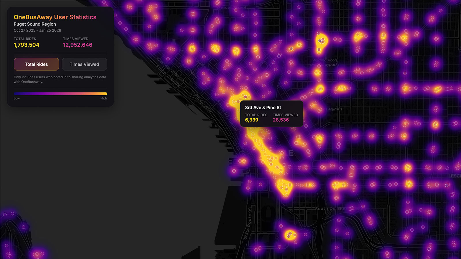
Interactive heatmap of OneBusAway transit stop usage in the Puget Sound region. Combines Google Analytics usage data with GTFS transit data.
Features
- Dual Metrics - Toggle between Total Rides and Times Viewed to understand different usage patterns
- MapLibre GL Powered - GPU-accelerated rendering for smooth, client-side visualization
- Interactive Exploration - Zoom in to see individual stops with hover tooltips showing names and statistics
- Privacy First - Only aggregated, anonymized data from users who opted in to analytics
- Embeddable - Functions as a standalone page suitable for iframe integration
- Multi-Source Data - Integrates GA4 usage metrics, GTFS stop locations, and CARTO basemap tiles